Advisory Committee – Building Capacity to Implement the ‘Risk-based Framework’

The Environment, Energy and Science (EES) Group is delivering a water quality initiative to improve the management of urban and rural diffuse source water pollution in NSW, as part of their commitment to implement the Marine Estate Management Strategy (MEMS) 2018-2028.

A key tool being used for this initiative is the ‘Risk-based framework for considering waterway health outcomes in strategic land use planning decisions’ (Risk-based Framework).The Risk-based Framework is a protocol that decision-makers, such as councils and environmental regulators, can use to help manage the impact of land-use activities on the health of waterways in NSW. Since the release of the framework, it has been piloted in several Councils in NSW, including Northern Beaches Council, and recognized in the Greater Sydney Commission’s district plans and the Marine Estate Management Authority’s 10-year Strategy.

One of the actions from MEMA’s Stage 2 Implementation Plan is to build capacity for stakeholders to implement the framework through delivery of guidance materials, industry forums and an online portal (Action 1.2). To achieve this an advisory committee has been set up and the SCCG’s Executive Officer has been invited to stand on this committee. The SCCG look forward to representing the interests of member councils to ensure that the outputs of the building capacity project are relevant to their activities.

Sand Management Working Group

The Sand Management Working Group was established in November 2019.

The group’s purpose is to ensure a collaborative approach and peer-to-peer learning in tackling sand management issues faced by councils in Sydney such as beach erosion and accretion on coastal and estuarine beaches. The group comprises member councils with an interest in sand management including Sutherland Shire, Bayside and Northern Beaches councils and Woollahra Municipal Council. It also includes key representatives from Department of Planning, Industry and Environment, National Parks and Wildlife Service (NPWS) as well as industry and academic representatives. Meetings are held quarterly and include expert presentations and project presentations and updates from member councils.

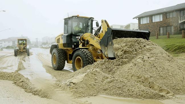
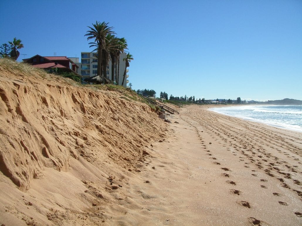
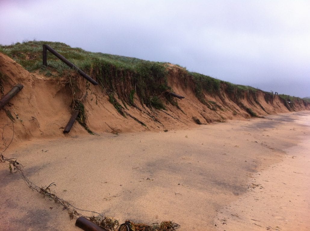
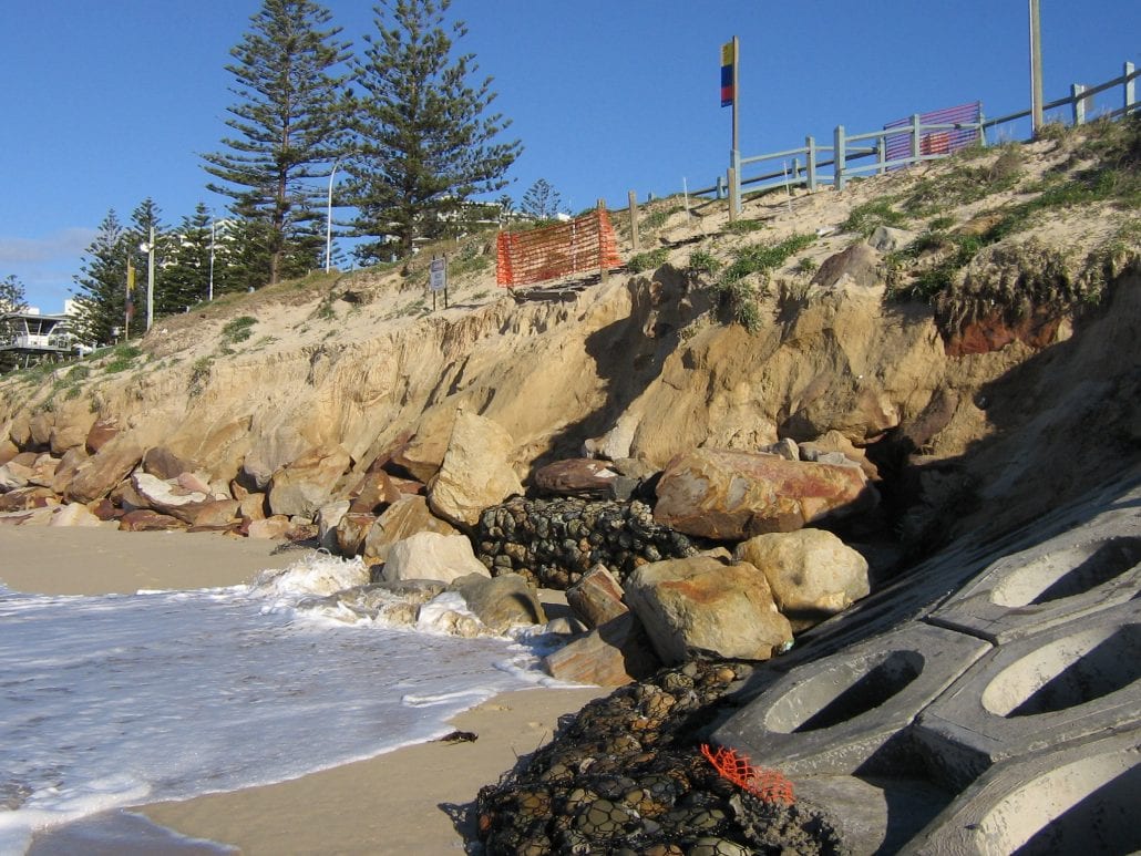
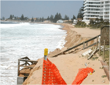
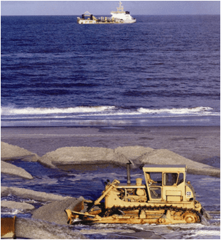
Sand Management, in particular beach nourishment, has been recognised as a potential adaptive option to offset the adverse impacts of seal level rise and increasing storm intensity on coastal assets including the retention of public beaches. (Gordon, 2009 ‘The Potential for Offshore Sand Sources to Offset Climate Change Impacts on Sydney’s Beaches’). The potential devastating impacts are evident from the 2016 ‘D Day Storm’ which moved 410,000m3 of sand from the Collaroy-Narrabeen beach alone during this time. Several other councils are also experiencing beach erosion and, in some areas, unwanted beach accretion which also has an impact on private and public assets. Short term and long term impacts are considered in both local and regional contexts and opportunities for broad scale regional beach nourishment programs are explored.

To date, presentations have been provided by representatives from DPIE, NPWS, University of New South Wales, Geological Survey of NSW, MidCoast Council, Hunter & Central Coast Development Corporation and all participating councils on the Sand Management Working Group. All presentations have been recorded and are available for members in the ‘Members Area’ of the SCCG website.

A copy of the Terms of Reference is also available for members in the ‘Members Area’.

Adapting Priority Coastal Recreational Infrastructure for Climate Change

The SCCG was successful in receiving a Building Resilience for Climate Change Grant in 2017 to fund the ‘Adapting Priority Coastal Recreational Infrastructure for Climate Change’ Project.

Coastal public recreational infrastructure can be highly vulnerable to the impacts of contemporary coastal hazards that will be exacerbated by climate change. These assets can receive large amounts of funding every year for reactive remediation and maintenance following damage. The outputs of this project will assist Councils in managing these recreational assets with respect to rising sea levels and other impacts of climate change.

The NSW Governments’ Manly Hydraulics Laboratory (MHL) and Engineers Australia through its National Committee on Coastal and Ocean Engineering (NCCOE) were engaged by SCCG to develop a decision framework for recreational coastal infrastructure assets which:
• implements NCCOE’s guidelines for coastal infrastructure asset management and planning;
• focuses on climate change vulnerability; and
• can be used as part of Council’s IP&R (Integrated Planning and Reporting) framework to help define maintenance/renewal costs and to establish triggers based on discounted future costs under a preselected adaptation strategy.

Based on the findings of a survey of NSW coastal councils, MHL developed an assessment methodology incorporating multi-criteria valuation assessment (MCA) to:
• design an assessment tool around targeting asset vulnerability to coastal hazards;
• establish an holistic approach to asset assessment; and
• support capital expenditure applications and an ability to accommodate varying levels of data availability.

Outputs from the tool can assist Councils to:
• determine strengths and weaknesses of a coastal recreational asset based on the dimensions of the MCA;
• indicate options and indicative costs for various adaptation strategies;
• set trigger levels for future adaptation work; and
• rank assets against others entered by the user to aid in prioritisation of resources.

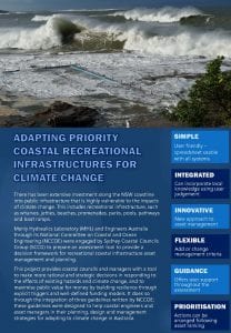
To download the project Factsheet click on the image below.


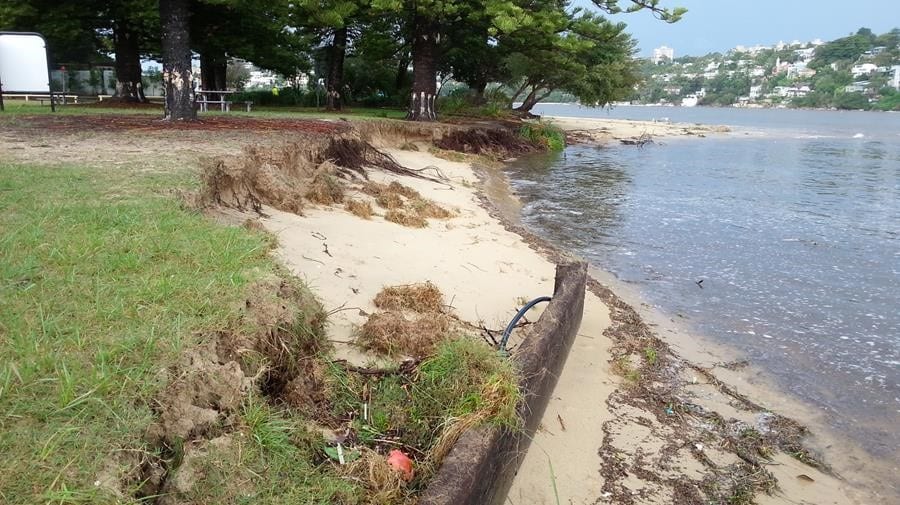
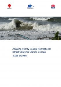
The tool was tested on over ten recreational infrastructure assets within the local government areas of three NSW coastal councils. Three case studies have been developed using recreational assets including an urban rock pool, and urban coastal park and a rural estuarine jetty, to highlight the applicability of the tool.

Read the Case Studies Report for more information on the three case studies. To download click on the image below.


This project was presented at the NSW Coastal Conference 7-9th November 2018.

The Assessment Tool is accessible for all NSW councils.  To download the excel based tool click here.


Coastal Councils Planning for Climate Change

Introduction:

In 2007/2008 the SCCG engaged the NSW Environmental Defenders Office to undertake an assessment of Australian and NSW legislation and government policy provisions in relation to climate change relevant to regional and metropolitan NSW coastal councils.

Aim and Objectives

The aims of the project were to:

  1. To identify where and within what legal and implementation context the terms climate change, greenhouse and sea level rise occurred within all legislation, planning instruments and policy relevant to coastal councils in NSW; and
  2. Provide a discussion of responsibilities of local government to implement the provisions identified.
Outcomes / Outputs

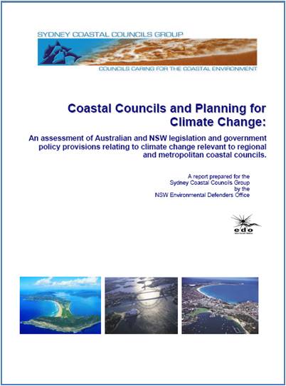
The project produced a report titled Coastal Councils Planning for Climate Change. This report provided an assessment of Australian and NSW legislation and government policy provisions in relation to climate change relevant to regional and metropolitan NSW coastal councils. Findings and recommendations for the report focussed on the statutory obligations and potential common law liability of coastal councils in NSW.

The Coastal Councils and Planning for Climate Change Report can be downloaded here.

A Method for Assessing the Vulnerability of Buildings to Catastrophic (Tsunami) Marine Flooding

Introduction

Sydney’s low-lying coastal infrastructure is vulnerable to the impact of catastrophic marine floods associated with tsunami and storm surges. The future impacts of such floods will be worse than in the past because of climate related sea level rise and increased exposure at the coast. Coastal planners and risk managers need innovative tools to undertake assessment of the vulnerability of buildings and infrastructure and likely probable maximum loss located within their areas of responsibility. Such assessments will enable risk mitigation measures to be developed and challenges of long-term sustainability to be addressed. In 2008, the SCCG together with the Australian Tsunami Research Centre at the University of New South Wales commenced a collaborative research project titled “A method for assessing the vulnerability of buildings to catastrophic (tsunami) marine flooding”.

Aim and Objectives

The aim of this project was to apply a newly developed GIS vulnerability assessment tool to selected coastal suburbs of Sydney, evaluate and quantify the vulnerability of buildings at those locations to a hypothetical tsunami (or storm surge) flood based on the latest scientific understanding.

Outcomes / Outputs

The results are presented via a series of thematic vulnerability maps, in which different types of buildings are displayed using a colour code corresponding to the RVI score.

The overall project outcomes are delivered in three forms:

  1. 1:5000 scale maps of the RVI scores of all buildings within the two study areas;
  2. A report including a detailed description of the method, the results and a series of potential recommendations for Government(s) to increase their capability to deal with long-term risk mitigation
  3. A step by step ArcGIS user’s manual for applying this model to other coastal areas including a specific tool to be installed onto the GIS platform.

The project outputs, finalised in August 2009, include the Final Report, User Manual and Project Fact Sheet click on the links below.

Final Report

User Manual


In November 2011, the SCCG partnered once again with the UNSW Pacific Tsunami Research Centre and Natural Hazards Research Laboratory (UNSW APTRC) to build upon this project and assess coastal vulnerability to multiple inundation sources. This 2-year project will develop a multi-hazard tool to assess the vulnerability of buildings and critical infrastructure to extreme marine inundatations caused both by tsunamis and storm surges.


Systems Approach to Regional Climate Change Adaptation Strategies in Metropolises

Introduction

The Systems Approach to Regional Climate Change Adaptation Strategies in Metropolises project developed and tested an integrated, systems approach to assisting the 15 SCCG Member Councils in assessing their vulnerability to climate change and the barriers and opportunities associated with adaptation at the Local Government scale. The project also seeked to demonstrate the value of coordinated regional-scale responses to climate vulnerability through Local Government cooperation. The SCCG partnered with CSIRO’s Climate Adaptation Flagship and working in collaboration with the University of the Sunshine Coast, as part of the Australian Government Department of Climate Change (DCC) National Climate Change Adaptation Program.

Aim and Objectives

The aim of the project is to develop and trial a method for a systems approach to regional climate change adaptation strategies in large urban areas through:

  • Developing and testing an integrated (systems) method to generate information about the likely impacts of climate change and feasible adaptation strategies in the Sydney region.
  • Deepening the understanding of the likely impacts of climate change and resulting adaptation options in the Sydney region through integration of existing models, generation of new knowledge where there are significant gaps, scenario analysis, an analysis of adaptive capacity, and assessment of demonstration projects.
  • Assessing the transferability of the integrated (systems) method to other large urban areas.
  • Improve the capacity of councils to respond and adapt to climate change.
Outcomes / Outputs

The project will benefit SCCG Member Councils in the Sydney region and other Councils in large urban areas by:

  • Generating information about the likely impacts of climate change and feasible adaptation strategies in the Sydney region;
  • Deepening the understanding of the likely impacts of climate change through the identification of the barriers and opportunities to adapting to the impacts of climate change;
  • Building the capacity of stakeholders by making recommendations and identifying key interventions for future management decisions;
  • Working with stakeholders to build adaptation strategies into institutional structures and processes.


Adaptation Actions for Local Government

Introduction

This research undertaken by Edward Boydell (from the Fenner School of Environment and Society, Australian National University) examines adaptation to climate change in the context of local government practice. Increasing attention is being paid towards the practical dimensions of implementing adaptation.

The honours research thesis, investigated the emergence of adaptation to climate change in local government practice. Three SCCG Member Councils participated in the qualitative research project, which captured a snapshot of their adaptation-related activities from late 2009 to early 2010. These councils had previously been involved in the “Systems Approach to Regional Climate Change Adaptation in Metropolises” (hereafter “Systems Approach”). This research project was a collaboration of the SCCG, CSIRO and the University of the Sunshine Coast.

The research builds upon this work, particularly the proposed “adaptation actions for local government”, and aimed to focus on what can be learnt from subsequent, emerging practical examples of adaptation in local government. Guided by the broad research question ‘How is adaptation to climate change emerging in practice?’ the following specific research questions where addressed:

(Q1) What practical adaptation activities are Councils and individual officers engaged with?

(Q2) How is the development and implementation of these activities connected to the broader context of local government?

(Q3) How do social processes come together with this context to shape adaptation learning and practice?

(Q4) What can the resulting trajectories of practice reveal about overcoming barriers to adaptation?

Outcomes

‘The findings suggest that although local governments have only recently begun to attend to climate change impacts and adaptation, it is the interest and motivation of individual actors that has driven the agenda forward. I identified nine key responses to climate change, which were influenced by policy and external research, internal factors within councils, and interaction with the community. Although a number of these activities were ad hoc, they were starting to coalesce into a strategic direction of adaptation. I demonstrate that learning occurs at variety of scales, with actors drawing upon their practical experience, local knowledge, local and extended networks and known information resources. The analysis highlighted that adaptation practice is facilitated by a level of personal and organisational ownership of activities, with connection to broader strategic directions and the identity of the organisation. It also proposes trajectories of practice and avenues for transcending barriers to adaptation.

Connecting climate change adaptation, learning, and practice places the actions of local government staff at the centre of this inquiry. It acknowledges that their experience provides important and legitimate insight into the organisational context that shapes this action. The research develops and demonstrates a novel and insightful approach to understanding the practice of adaptation, through the situated learning perspective. Greater understanding of adaptation practice and trajectories of change are vital for enabling, supporting and enhancing action to address climate change.

Thesis:
Adaptation to climate change in practice. Learning from a local government case study.

Monitoring, Evaluating and Reporting Climate Change Adaptation in Local Government

Aim and Objectives

The research is based on the ‘Systems Approach in Metropolises’ project and aims to explore opportunities for mainstreaming adaptation through monitoring, evaluation and reporting. The ‘Systems Approach in Metropolises’ project conducted by the SCCG in collaboration with the CSIRO and the University of the Sunshine Coast has shown that adaptation activities in SCCG Member Councils are currently not being systematically evaluated. Yet doing so could provide an opportunity for mutual learning and help spreading best practices. It would also assist stock taking by the state government as well as providing a helpful tool for community reporting. Thus following the recommendations of the ‘Systems Approach’ project this research will explore ways in collaboration with Councils to monitor, evaluate and report on adaptation progress.

The major benefits of this Masters research include:

  • Better understanding of how Councils approach monitoring & reporting of adaptation measures;
  • Opportunities for learning among the SCCG Member Councils and from Councils of other jurisdictions;
  • Identification of best practises in mainstreaming adaptation; and
  • Providing a provision of research so to enable development of a climate change adaptation monitoring framework for local government and others.

For more information contact Timo Leiter, Institute of Environmental Studies, University of NSW: Timo.Leiter@gmx.de

Beach Sand Nourishment Scoping Study: Maintaining Sydney’s Beach Amenity Against Climate Change Sea Level Rise

Introduction:

In order to address the issues of continual shoreline erosion in these “at threat” sites to a point where decision makers can commit long-term physical and financial resources, it is essential to understand the environmental, physical and economical needs and feasibility of utilising offshore marine sand source for beach nourishment purposes. The task of assessing the feasibility of these aspects is detailed and complex and seeks to advance government policy on the potential use off marine resources of sand for nourishment purposes.

In 2008 the SCCG in partnership with its project Steering Committee obtained support under the Natural Disaster Mitigation Program to undertake this study.

Aim and Objectives

This study aims to provide a significant knowledge and resource base on these issues and develop the strategic framework and direction for addressing identified data gaps, further studies (as may be required) and data collection requirements necessary for the respective Greater Metropolitan Region councils to make more fully informed decisions on the feasibility of pursuing offshore marine sources of sand to satisfy requirements for artificial sand nourishment.

Scope of Work

The study focuses in detail on the application of sand nourishment to the proposed case study sites: Collaroy / Narrabeen, Manly and Bate Bay (Cronulla) beaches; but also provides generic consideration of sand nourishment requirements in other areas of the Greater Metropolitan Region facing immediate threat including: Pittwater LGA – Bilgola Beach; Gosford LGA: Wamberal, North Avoca and Terrigal beaches; Newcastle LGA: Stockton Beach. Similarly the study provides a generic assessment of the sand nourishment requirements to offset the loss of recreational amenity within the Sydney Greater Metropolitan Region open coast beaches from projected rise in mean sea level due to climate change.

This scoping study looked at the information, data currently available in relation to the environmental, physical, social and economic aspects of utilising these available sands to meet immediate and medium term requirements of the adopted strategies for these beach environments. The study provides a significant knowledge and resource base on these issues and developed the strategic framework and direction for addressing identified data gaps, further studies, data collection requirements and methodologies necessary to implement such a formal proposal to Government(s).


Beach Sand Nourishment Scoping Study – Maintaining Sydney’s beach Amenity Against Climate Change Sea level Rise

Media Release

Frequently Asked Questions

Facts and Figures

Mapping and Responding to Coastal Inundation

Introduction

Given that it is impossible to stop climate change impacts and resultant sea level increases and more intense significant storm events, Local, State and Federal authorities are faced with the need to consider key areas at immediate to medium threat. This information needs to then be applied to planning mechanisms and management strategies to cope with future impacts of increased coastal inundation and erosion directly impacting existing, redeveloped and new development within their coastal landscape areas.
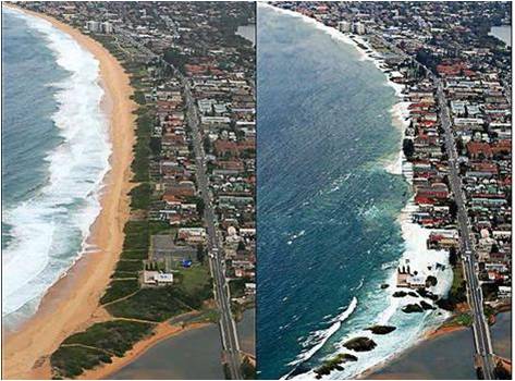
This project maps areas of risk, utilising sophisticated modeling together with Councils own information sources Inundation(eg LiDAR technology) to determine risk and develop consistent model planning and management responses in consultation with relevant state government agencies and the broader community.

In 2009 the SCCG secured grant funding under NDMP to undertake the project with the CSIRO entitled Mapping and Responding to Coastal Inundation

Aims and Objectives

  • Enhance the capacity and knowledge of local governments and other decision makers in the region to prepare for and adapt to climate change (specifically focusing on sea level rise and extreme water levels, eg storm surges),
  • Develop an approach to climate change assessment and adaptation with a particular focus on relevant planning provisions in identified immediate and future coastal inundation (flood) zones and potential beach erosion escarpments,
  • Develop and distribute associated community risk disclosure information and corresponding community and stakeholder education programs to better inform communities of the degree of risk(s).
Project Outputs

The SCCG engaged the Environmental Defender’s Office NSW (EDO) to conduct a comparative assessment of:

  1. Australian State and Territory planning and coastal legislation and policies that address sea level rise, coastal erosion, coastal inundation and storm surge; and
  2. regional and international jurisdictions.

The results of this analysis are presented in the report prepared by the EDO, a copy of which can be downloaded by clicking on the following link:


Audit of Sea Level Rise, Coastal Erosion and Inundation Legislation and Policy


For the Stage Outcome Reports, please click on the report titles below.

Stage 1: Effect of Climate Change on Sea level Rise and Extreme Sea Levels:

A set of high resolution hydrodynamic model simulations were produced in order to obtain current climate, as well as storm tide return level estimates and sea level rise considerations.
Stage 2: Development of model planning provisions to integrate sea level rise and extreme sea level events into relevant planning strategies of the SCCG:


  • Assess existing planning strategies (Australia and Internationally)
  • Identify gaps in information, knowledge, capacity or external barriers
  • Develop model provisions, actions and implementation strategies
Stage 3: Develop and distribute community risk disclosure information and corresponding community and stakeholder education program:


Assess existing education strategies within Australia and Internationally for addressing and communicating sea level rise and flooding impacts.

  • Consultation with member councils and targeted community groups and individuals to identify gaps in information, knowledge and capacity as well as internal and external barriers for message transfers.
  • Utilising outcomes of stage 1 and 2 and incorporating the above to develop and deliver freely available educational tools that build the understanding and capacity of relevant stakeholders.
PROJECT LAUNCH

Southern Function Room, Town Hall House, 4 October 2012.

This project was launched to assisted attendees to understand project outcomes and outputs to take back to their own organisations for use.

There was a Panel Discussion with the key speakers of the day. This allowed attendees to ask questions about the project outputs and the NSW 2012 Stage One Coastal Reforms.

The launch also involved the establishment of a secure and temporary FTP server to provide Member Council access to the project outputs including all mapping information, stage outcome reports and associated meta date information.

Click here for the Project Launch Report.

Click here for the NCCARF Climate Change Adaptation Good Practice Case Study of the SCCG Mapping and Responding to Coastal Inundation project.